Saturday, December 31, 2011

Exploring "The Greatest Grid"

The new exhibit "The Greatest Grid" at the Museum of the City of New York is well worth a visit for anyone with even a passing interest in urban planning or the history of the city.  An accompanying exhibit of speculative urban designs, however, provides evidence that the heroic materialist ideal has been slow to loosen its grasp over the minds of some practitioners in the fields of architecture and urban planning.

Simeon DeWitt's 1794 plan for Albany:
large blocks and wide streets.
Before featuring a few of these, though, a few words on the main exhibit.  Despite curator Hillary Ballon's evident admiration of New York's grid plan, the exhibit is evenhanded in its presentation, quoting liberally from critics such as Clement Clarke Moore (who famously quipped that the commissioners were "men who would have cut down the seven hills of Rome.")*  Not only the early 19th century era, but the entire subsequent century of growth and change is covered.  The featured historic maps and photos of the city are beautiful and fascinating.

There are also copies of the plans of other cities of the era, including L'Enfant's plan for Washington D.C. and (later commissioner) Simeon DeWitt's 1794 plan for a northern extension of Albany, which shows the same grid of oversized blocks and uniformly wide streets that would reappear a thousand times in the settlements of the following century.  The web of narrow streets and small blocks by the waterfront, a legacy of Dutch administration, was, as in New York, not eradicated, but evidently was not seen as an object of any interest, except as an example of a characteristics to be avoided.

Of particular interest to me were the photos of the shantytown settlements that occupied large parts of Manhattan through the end of the 19th century.  One interesting fact from the exhibit: Jacob Riis, the famous social reformer, opposed the eviction of shantytown inhabitants and the demolition of their dwellings, arguing that the self-built homes of the squatters provided accommodations superior to, and more affordable than, the tenements of the Lower East Side.

The partner exhibit, "The Unfinished Grid: Design Speculations for Manhattan", is interesting for somewhat different reasons: not so much for introducing viable design proposals for the city, but for shedding light on the imaginations of contemporarary architects and planners.  The proposals on display seem to draw from three basic sources of inspiration:
  • Heroic Materialism. This term, which I'm borrowing from Nathan Lewis (who in turn borrowed it from Kenneth Clark), describes an aesthetic preference for monumental scale and the image, as much as the reality, of technology and engineering prowess.  Nathan dates it to approximately 1780, although it has Baroque antecedents and yet truly came into its own only around 1900, when Western imaginations were already trending toward urban gigantism. It grew in influence in the 1920s and 1930s, with the ideas of Corbusier and other Modernists, and remained the dominant force in theoretical urban thinking at least through the 1960s (the suburban reality on the ground notwithstanding).
  • "Green" Urbanism.  Although this line of thinking was anticipated by the Broadacre City of Frank Lloyd Wright and the garden city movement, the current incarnation emphasizes an integration of natural forms, and especially agriculture, into urban areas, as well as sustainable building practices, without necessarily disparaging density.  Still, there is a degree of overlap with heroic materialism: "green" practices often rely on high-tech, rather than traditional technologies, while the tower-in-the-park form advocated by the Modernists, heroic materialist in scale, also reflects garden city influences.  Green projects can also be incremental, as below, but share a distinct focus that differentiates them.
  • Incremental Urbanism. Only two of the eight featured projects reflected this approach, which seeks to make more modest and gradual changes to the urban fabric, observing the city as it stands, reinforcing those qualities already found to be beneficial while addressing perceived shortcomings.  It is by far the most "Jacobsian" of the three, but also the least flashy, and least likely to lend itself to dramatic illustrations or other flights of visual fancy.
On to the exhibits:

Heroic Materialism: At left, giant skyscrapers dwarf the Empire State Building in a plan that called for zoning limits to be rescinded for all lots facing on north-south avenues (and presumed that developers would respond with towers obviously inspired by the Emerald City). At right is an architect's idea of some vast megastructure looming over the northern end of Central Park, with father and young son enjoying the park underneath projecting towers.

What about building 40-story towers on landfill sunk into the 50-foot deep waters of the Hudson river?  Cruise ships thread channels between buildings.


From a Green Urbanism perspective, why not tear up 71st street and replant it with wheat?  At least the streets would be car-free under this proposal, and the view is human-scaled and at street level.  More fundamentally, this proposal does recognize that the vast amount of Manhattan given over to wide surface streets represents a greatly under-exploited urban resource.


Tesselated housing in the sky -- they can't be serious, right?


Finally, 6 1/4 Avenue, by Ksestudio, which proposes opening a new 40-foot wide street between and parallel to 6th and 7th Avenues that, according to the designers, "activates the depth of the base of the New York tower by multiplying the public perimeter of the block."  Simple and elegant, simultaneously addressing the excessive width of the midtown blocks and the lack of additional north-south routes while greatly adding to the amount of accessible street frontage.  Feasible?  Maybe, maybe not, but the method is thoughtfully incremental.  No flashy graphics were included, just clear and concise figure-ground drawings.


That's all I have for 2011. See you in the new year!

*Stephen Smith has recently covered some other critiques of the plan here.

Friday, December 30, 2011

Downtown is for People

"It has sometimes been urged that this [low residential density in American cities] is largely the result of the development of the electric street railway in America, but the causal connection is not apparent. . . . It should rather be said that the American penchant for dwelling in cottage homes instead of business blocks after the fashion of Europe is the cause, and the trolley car the effect." -Adna Ferrin Weber, The Growth of Cities in the Nineteenth Century (1899).

"By the end of the [nineteenth] century, if not earlier, downtown was synonomous with the business district virtually everywhere in urban America. ... As well as a new word, "downtown" was, as Webster's noted, an American word.  It was virtually unknown in England and other Western European countries. Well into the early twentieth century English travel writers thought it necessary to explain the meaning of "down town" to their readers.  ... American reporters and public officials routinely refer to "downtown" in cities all over the world, but the word does not have much meaning outside the United States.  For downtown was not only an American word, it was also a uniquely American place." -Robert Fogelson, Downtown, Its Rise and Fall, 1880-1950 (2001).

The "penchant for dwelling in cottage homes":
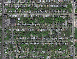
"Sprawl" circa 1900, Rochester, NY.
As the excerpt from Adna Ferrin Weber's book shows, the study of suburban growth in America goes back much further than 2001's Suburban Nation, 1993's The Geography of Nowhere or 1985's Crabgrass Frontier.  A distinctively American pattern of low-density residential expansion in single-family detached homes was starting to be noticed by writers as early as the late 1800s.  Nearly 150 years earlier, a perceptive observer might have noted the significant differences between the small towns of Europe and those of North America, differences which portended the dominance of the "cottage home" in the United States, and Canada, in the centuries to come.

As Robert Fogelson points out, however, the existence of a small central district devoted to business and commerce was perceived as normative, rather than as a distinctively American feature.  Even today, of the hundreds or thousands of extant books and studies critiquing the form of American cities, the majority focus on suburban sprawl, with fewer specifically addressing downtown areas, much less critically.*

More typically, the 19th century commercial downtown is set up as an object of nostalgic admiration in spite of its generally unimpressive 20th century track record.  The reasons for its decline, whether absolute or relative, are not usually attributed to anything inherent in its conception or layout, but in the damaging acts done to it: among them freeway construction, urban renewal, street widening, and a rash of anti-urban regulations ranging from parking minimums to setback requirements. If downtown died, the cause was malpractice based on a faulty diagnosis, not any underlying illness.

Could it have been, though, that downtown was doomed to decline or stagnation from the start, at least in the form envisioned by 19th and early 20th century Americans?  The fundamental problem was this: for a large and growing city, continued high-density commercial growth in the center and omnipresent low-density residential growth elsewhere were ultimately incompatible.  Incompatible, because low-density growth required rapid outward expansion, and that same expansion carried increasingly large proportions of the urban population beyond a reasonable travel distance from the center, at least before the arrival of the automobile.

The story of downtown, as Fogelson tells it, is of increasingly desperate attempts by downtown merchants to fight the effects of this trend without sacrificing their monopoly on commercial space.  It was ultimately a losing battle, however, since the very transportation devices perceived by the commercial interests as great centralizers the omnibus, the streetcar, and at last the automobile were perhaps, as Weber observed, only symptoms of an epic decentralization. 

Each device, moreover, led inexorably to its successor: the omnibus and railroad carried the wealthy to outlying mansions, whose dispersal created a built-in market for speedier streetcar service; the streetcar suburbs, in turn, with their low-density and segregated uses, created a built-in market for the automobile. 

Transportation, in this view, was in the United States** often a lagging indicator of land use changes driven partly by personal preference, partly by increasing wealth, and partly by the sheer growth of urban populations and the arrival of heavy industry. The auto, at last, shattered the monopoly of fixed-route transportation lines and, by connection, the monopoly of downtown itself. 

The tendency, at this point, is to fault the automobile for the decline of downtown, as though a different approach to transportation policy in the critical years from 1890-1930 might have altered urban trajectories.  But this seems unlikely.  Fogelson describes how large and wealthy cities like Detroit and Cleveland did launch major, but ultimately failed, efforts to construct subways in the 1920s.  It could be said that Detroit was a city built around the automobile before the automobile existed.  Low-density, use-segregated, single-family detached homes on wide streets lent themselves to motorized personal transport much more than mass transit.  And once the car had arrived, why not simply move the department store, the supermarket, and even the workplace itself closer to one's residence? 

Downtown commercial interests, however, were convinced that downtown's problem was not its form and land use patterns, but in its lack of accessibility to shoppers and commuters.  The suburban preference, rightly or wrongly, was taken for granted in most places.  Once cars began to proliferate in the 1920s, the response was not, in most cases, to entice suburbanites with visions of urban living, but to either make valiant attempts at mass transit systems or, more often, to turn over large swathes of the downtown to the car.  As Norman Garrick and Chris McCahill have shown, this policy sometimes (as in the case of Hartford) resulted in an absolute decline in downtown jobs, indirectly assisting the ongoing decentralization of business.

Jane Jacobs knew better.  In the early days of urban renewal, and only two years after the passage of the Highway Act of 1956, she proclaimed in Fortune magazine that "Downtown is for People," by which she meant not only commuters and shoppers, but residents as well.  For decades her advice went unheeded, but it's still one of the best rallying cries out there for rethinking the American downtown.

*For just a small sampling, see Sprawl: A Compact History; Streetcar Suburbs; Crabgrass Frontier; Bourgeois Utopias; Suburban Nation; Building Suburbia; Geography of Nowhere.  Books focusing on downtown are much rarer: Fogelson's work and Alison Isenberg's Downtown America are the only general, book-length treatments I'm aware of, setting aside Death and Life, but if anyone knows of others I'd be glad to learn.

**Kenneth Jackson in Crabgrass Frontier describes how streetcars were generally much slower to catch on, and ridership lower, in European and Japanese cities, even though these were denser than the great majority of American cities.

Thursday, December 22, 2011

Roosevelt Island and Insular Urbanism

Stephen Smith and Cap'n Transit have been discussing the recent news that Cornell University-Technion-Israel Institute of Technology's graduate school of applied sciences will be constructed on New York City's Roosevelt Island, a 147-acre sliver of land set squarely in the middle of the East River. 

Although Stephen's article questions the wisdom of subsidizing physical expansion of the technology sector in poor and middle-class neighborhoods, both he and the Cap'n also critique the proposed design of the new campus (below), which Stephen has called "quasi-Corbusian:"  

The proposed plan, from the Cornell website.
Citing Nathan Lewis, Cap'n instead suggests a traditionally urban form incorporating "really narrow streets" for the new campus.  As it turns out, there are abundant examples of traditional urbanism on small or narrow islands that might serve as models, as pre-industrial cities often formed on or around mid-river islands for reasons of security or ease of transportation.

Here for instance is Paris' Île Saint-Louis, a 27-acre island only slightly narrower than Roosevelt Island.  Although no high rises are present, population density here is approximately 60,000 per square mile, with room to spare for modest but well-defined park space and a river promenade no more than one minute's walk away for any resident.


This is Chioggia, a canal town on the southern end of the Venetian lagoon which, although charming in its own right, is completely overshadowed by its famous northern neighbor.  I visited this town several years ago, and in spite of the extremely high ground coverage of buildings, there was no sense of claustrophobia.  The need for park space is reduced when the waterfront is so readily accessible.


Rhoda Island, adjoining central Cairo, has an evident early or mid-20th century plan in the garden city manner, with relatively wide streets on a modified grid.  Still, as virtually all buildings are mid-rise apartments, population density is very high. The Nile is no more than 500 feet away from any building.

For contrast, scroll back up to the proposed campus and compare the arrangements of space, the density of the built form, and the networks for pedestrian circulation.  Although the site claims that the primary building will be "the largest net-zero energy building in the eastern United States," there is nothing particularly green in underusing high-value urban land adjacent to mass transit.

The Cornell plan, rather than being a departure from current planning practice on the island, actually continues an ongoing trend away from more traditional forms.  The history of post-1950 urban development on Roosevelt Island is a interesting story in itself (for more see here and here), but at least at the outset, in the late 1960s and 1970s, planners conceived of a car-free haven densely built up with apartments. In spite of rather dismal architecture, the result (at right) was strikingly urban, and moreover achieved a sense of place through 1) keeping the street fairly narrow; 2) curving the street, creating visual enclosure; 3) slightly varying the angle at which buildings face the street to create gentle variations in right-of-way width; and 4) incorporating traditional city elements such as the covered arcade, at right.  The result, in spite of the architecture, is quite good, and it is probably no coincidence that the wikipedia page for the island features this very same perspective.

More recent developments have abandoned this approach, however.  Monolithic new apartment buildings to the south are placed in the middle of broad expanses of grass lawn in an approach far more reminiscent of 1960s tower-in-the-park urbanism than is the case for the older buildings to the north.  Rather than defining the street, these apartments are objects floating loosely in space, unrelated to each other or to the topography of the island.  An aerial view shows the extremely low footprint of these buildings – an extravagant use of land even by the standards of 1960s public housing  and their lack of engagement with the waterfront across the street.  Further, does this plan leave any room for future infill or expansion?  Most unbuilt land appears spoken for as roadway or dedicated park space.

If, on the other hand, builders and planners wish to provide a traditional urban environment, there are a multitude of successful examples waiting to serve as inspiration.  If not on a narrow island, with mass transit access, adjacent to Manhattan, then where?

Friday, December 16, 2011

Friday Read: Allan Jacobs on Urban Design

Allan Jacobs' Great Streets is an urbanist classic, combining a planner's eye for the details of the urban form with an appreciation for the aesthetics of traditional urbanism.  The influence of the book is apparent in many of the posts I've authored since this blog began one year ago.   Rather than excerpting from that book, however, today's post features an earlier essay by Jacobs and Donald Appleyard, Toward an Urban Design Manifesto, which in the early 1980s laid out the authors' attempt at formulating basic principles for what they termed a "livable urban environment." 

The underlying idea is that of moving away from the typically American notion of dense urbanism, in the form of a high-rise downtown, as the exclusive realm of business and commerce, and instead considering ways to construct a dense urban environment that is appealing as a place to live, rather than simply to work or to shop.  The late 19th and early 20th century American city, as impressive as its downtown appears to us in old drawings and photos today, utterly failed at this task for the most part.  In spite of notable successes in New York and Boston, cities which had traditions of dense residential living predating the industrial revolution, most places failed to offer a compelling vision for apartment or very high-density single family living to middle class families. 

The principles the authors set out thirty years ago lay the foundation for thinking about what conditions are required for a sound urban environment:

"There are five physical characteristics that must be present if there is to be a positive response to the goals and values we believe are central to urban life. ... All five must be present, not just one or two. There are other physical characteristics that are important, but these five are essential: livable streets and neighborhoods; some minimum density of residential development as well as land use; an integration of activities -- living, working, shopping -- in some reasonable proximity to each other; a manmade environment that defines public space (as opposed to buildings that, for the most part, sit in space); and many, many separate buildings with complex arrangements and relationships."
Still, the authors warn, "the quest for livability, if pursued obsessively, can destroy the urban qualities we seek to achieve."  Excessive street width in the name of safety and sunlight; excessive green space in the name of health and recreation; excessive setbacks for noise and privacy; all these, the authors note, can undermine the density and enclosure essential to maintaining an environment that is both dense and appealing.  A minimum density, the authors surmised, was 15 units per acre, a figure squarely in the middle of the range Jane Jacobs derisively termed a "semisuburb," (Death and Life, p. 273), though in the prologue Jacobs suggests that that figure ought to have been set higher.

These points may seem obvious or elementary from today's standpoint, but the observation that cities fundamentally must work to provide an appealing environment for residential living remains a primary challenge for American cities today.

Monday, December 12, 2011

We Are the 25%: Looking at Street Area Percentages and Surface Parking

Several months ago I posted a chart in which I calculated the proportion of land given over to buildable space, right-of-ways and park space for each of 22 cities, or city neighborhoods.  In response, one commenter suggested that I perform the same exercise with off-street parking included as a separate category.  Although the work of Chris McCahill, which I featured last week, does just this for a number of cities, another commenter directed me to this thread at Skyscraper Page, where a number of people have mapped surface parking lots for several American cities.  I'd like to feature three of those here (which I've further edited to show parking structures and park space), while adding one of my own.  No guarantee of perfect accuracy is given. Red shows surface parking, yellow shows above-ground parking garages, and green shows park space:

Original work: photoLith

Houston, TX
Surface parking: 21.3%
Garage parking: 3.7%
Street area (including sidewalks): 39.7%
Total area for rights-of-way plus off-street parking: 64.7%
Park space: 2.6% (1.1% exluding Discovery Green)


Original work: photoLith


Little Rock, AR
Surface parking: 26.5%
Garage parking: 2.7%
Street area (including sidewalks): 32.0%
Total area for rights-of-way plus off-street parking: 61.2%
Park space: 0.0%

Milwaukee, WI
Surface parking: 11.5%
Garage parking: 3.8%
Street area (including sidewalks): 38.8%
Total area for rights-of-way plus off-street parking: 54.1%
Park space: 1.5%

Original work: Cirrus

Washington, DC
Surface parking: 1.1%*
Garage parking: 0.0%
Street area (including sidewalks): 43.3%
Total area for rights-of-way plus off-street parking: 44.4%
Park space: 2.53% (5.00% including Ellipse)
*Much of this is the large lot to the east scheduled for redevelopment as CityCenter

Although these numbers are interesting enough on their own, I bring them up to emphasize the importance of the street grid in determining the balance of buildable to non-buildable land.  Even the difference in unbuilt area between the downtowns most dominated by surface lots, and those most built out, as is the case for Houston and Washington, is no greater than the difference between Washington and the European cities with the most generous street allotments the Paris of Haussmann, with its broad boulevards, imperial Vienna of the 19th century, and Barcelona's Eixample, all of which devote around 25 percent of their area to streets. 

It is difficult to imagine a justification for much exceeding the 25 percent figure.  Many cities of similar size and far larger than those just mentioned make do with less, including Tokyo, Mexico City and Buenos Aires, while accommodating extensive mass transit systems.  The traditional city of narrow streets and small squares, typified by towns of medieval plan, find ten or fifteen percent perfectly adequate.  

In addition to their transportation function, streets can also be understood as a means of extracting value from underserved parcels of land.  The street removes a certain amount of property from tax rolls in exchange for plugging the adjacent land in to the citywide transportation network.  Access to the network, in turn, increases the value of the land for almost all uses.  For the process to satisfy a cost/benefit analysis, the value added should exceed that lost to the area of the streets plus the cost of maintenance. (This implies rapidly diminishing returns for increasingly wide streets, and helps explain why, in the absence of mandated minimum widths, most streets are made to be fairly narrow.)  For many of the gridded American cities of the 19th century, as I've written about before, planners failed to meet these objectives, although these decisions have long since been overshadowed by those of their 20th century successors. 

30-foot street in Montreal (Flickr/dumbo65).
The result, most notably in Portland, which devoted over 40 percent of its initial grid to streets, was simply to reduce the maintenance budget to zero, and to leave the streets a sea of mud.  This in turn resulted in a street network that was unsuited to any form of transportation, but particularly to walking (the late 19th century American city, despite the claims of some, was not a pedestrian's paradise). For Portland to have attained the 25 percent figure would have required streets of 30 feet rather than 60.  At that average width, it is likelier that paving would have been within the financial reach of the city of that era.

Still, it is difficult to conceive of a more wasteful pattern than modern Houston's, where redundant wide streets, and their associated infrastructure, are paved and maintained to serve dozens of vacant parcels.  Each new office tower, meanwhile, spawns hundreds of acres of tract housing on the city's periphery, as lots a few blocks away sit vacant on high-rise speculation. 

The one blessing in disguise of the form of a city like Houston or Little Rock is that it can allow planners a relatively free hand to reshape the existing street network.  Houston has in fact taken some halting steps in favor of more pedestrian-friendly streets, and planners like Christof Spieler have in mind truly urban visions for building out the remainder of the downtown.  It would be disappointing to say the least if these downtowns are eventually rebuilt and revitalized without rethinking the street plan itself.

Related posts:

Friday, December 9, 2011

Friday Read: Parking – In the Long Run

One of the things I most enjoy writing about on this blog are the nuts and bolts of built urbanism: square footage counts, ratios of building coverage to open spaces, measures of urban connectivity and so forth.  Thankfully, I've discovered that there's a community out there that enjoys reading and learning about these subjects too.  Although it's not glamorous work, often involving careful study of aerial maps, census figures and property records, it is an essential element in understanding the successes and failures of urban environments.  In comparison to some other trendier areas of urban study, it can get short shrift.

UConn's Chris McCahill enjoys researching many of the same things.  In a recent study which has been picked up at The Atlantic Cities and at Felix Salmon's blog, among other places (unfortunately not freely available on the web), McCahill and Professor Norman Garrick examined three New England cities New Haven, Hartford and Cambridge and attempted to track the change in downtown parking over a period of 50 years, using historic aerial photos as a guide.  The results of this meticulous study were contrasted with the change in population and employment in these same cities, with an eye toward testing the hypothesis that increased access to parking is correlated with commercial and residential real estate development.
Courtesy of Chris McCahill

The results are shown at right.  New Haven and Hartford, whose post-1950 urban renewal efforts were aggressive even by the standards of the day, lost both jobs and residents as parking increased.  Cambridge, on the other hand, which in 1981 lowered minimum parking requirements while imposing maximums, stemmed a population decline while substantially increasing the number of in-city jobs, all without making drastic interventions to the urban fabric.

A reasonable critique of the data might be to suggest that parking is only a consequence, rather than a driver, of urban prosperity.  As the industrial fortunes of New Haven and Hartford withered, built form may have given way to so-called "taxpayers," vacant lots held to reduce property tax burdens pending an upswing in the market for commercial real estate.

McCahill and Garrick's findings, however, suggest that increased parking in New Haven and Hartford was the result of conscious policy decisions. Mayor Biagio DiLieto in the early 1980s boasted that New Haven had more parking than any other Connecticut city, according to the study, affirming a commitment to “maintaining and improving parking facilities for workers, shoppers, and visitors in the downtown area.” Anyone who is familiar with Douglas Rae's City: Urbanism and Its End, can attest to how strongly the New Haven planners of the era (particularly during the mayorship of Richard Lee) believed the success of downtown to hinge on its accessibility to suburban motorists.  Not only surface parking but garage parking as well surged during this era.

A particularly surprising finding of the study is that despite their planners' focus on downtown as a setting for office buildings, rather than residences, New Haven and Hartford both suffered declines in employment from 1960 to 2000.  This occurred in spite of the fact that, in the mid-1950s, Hartford was still a largely mid-rise city built along a 300-year-old, semi-emergent street network, while the city of today is notable for a dramatic skyline of tall office buildings.  Again, the aerial view may hold a clue: a comparison of views from the 1950s and the 1990s provided by McCahill (see slides 6-9) shows that tall buildings at Hartford's core may have at best only compensated for the loss of hundreds of other low and mid-rise structures to renewal schemes.  Cambridge, on the other hand, which has a modest skyline and few tall buildings, has dramatically increased in-city employment during the past 30 years, even as its resident population grew.

Additionally, the study shows that per capita car ownership has increased faster in Cambridge than New Haven and Hartford, yet car use is less.  These figures are in large part due to much greater growth in incomes in Cambridge than in Hartford and New Haven in combination with an increased focus on non-automobile modes of transportation.  Has the focus on building spaces for working and living, rather than parking, and walking and biking, rather than driving, also resulted in an urban environment more appealing to middle-class and wealthy residents?

As the authors summarize their findings:
"This study reveals a need to reassess the impacts of the demand-driven approaches to parking provision that are conventional in most U.S. cities, including New Haven and Hartford. A more balanced approach to parking provision, like the approach taken in Cambridge, would address real parking demands in a way that acknowledges that excess parking contributes to increases in automobile use, which in turn exacerbate parking issues."
The damaging effects of minimum parking requirements have been widely reported, but this is one of the first studies to take a very long term look at their effects in the context of trends in other urban activities.

Friday, December 2, 2011

Living Space, Working Space and Centralization

Reading Alon Levy's recent post on transit and employment centralization started me thinking about the urban consumption of space, at home and at work. Does an office district, during working hours, contain an even denser concentration of people than its tall buildings might outwardly suggest? And what implications might this have for commutes, and for proximity of homes to workplaces?

Census figures tell us that Manhattan, which Alon discusses, has 2.30 million jobs and 1.59 million residents. What we want to know here, however, is how much space each person occupies, on average, both at home and at work. This requires determining the total amount of residential and non-residential square footage in Manhattan.

For commercial space, the task is easy, as the New York Property Tax Report catalogs it by gross square footage, showing a total of 591.6 million square feet of office and other non- residential space. Residential property poses more of a challenge, since the Report only lists the number of housing units, rather than the total square footage of residential space. What we do know, from 2010 Census Data, ACS information and real estate records, is 1) the total number of housing units in Manhattan; 2) the distribution of these housing units among studios, 1 BRs, 2BRs, etc., and 3) the average square footage of each type of unit sold over the past several years.

In combination, these three factors permit a rough estimate of the total square footage of residential space on Manhattan: 975.3 million square feet (representing the average apartment of 1151 square feet multiplied by 847,090 total residential units). Adding so-called "non-yield" space – including a building's hallways, lobbies and utility rooms, estimated at between 15 and 30 percent of an apartment building in colder climates – results in a gross residential area of 1.258 billion square feet. To find the square footage per person, all that remains is to adjust for vacant offices and apartments, again using census data:

These figures show the gross square footage per person, per building, with non-yield space included in the equation. Private apartment space per person would be considerably less – 553 square feet. (For anyone curious, the numbers also permit calculating an approximate floor area ratio for all of Manhattan: 1,850 m.s.f./640 m.s.f = 2.89 FAR).

What significance do these numbers have for the distribution of offices and residences in a city?  They do suggest the difficulty of achieving high proportions of commutes by foot or bike in a city dominated by a compact central business district of office towers, as a single tower will require more than triple its total square footage (in fact, more than that, as population figures include non-working age persons) in residential space to achieve a 1:1 match of living to working space on a per person basis.  Yet, even in Manhattan, residential space is overwhelmingly mid-rise.  The very dense Upper East Side can supply only a fraction of the workers, within walking or biking distance, needed to fill the office buildings of Midtown.  At its best, it will be a transit city; far more often, in the United States, it will be a car-dependent city.

As urban living becomes increasingly desirable, however, this balance can shift.  Conversions of Class B or C office buildings into condos can swiftly change the resident/employment ratio, as has happened in lower Manhattan.  Could the same ever happen in Midtown?  A little employment decentralization, after all, might not be such a terrible thing.